History’s Relevance
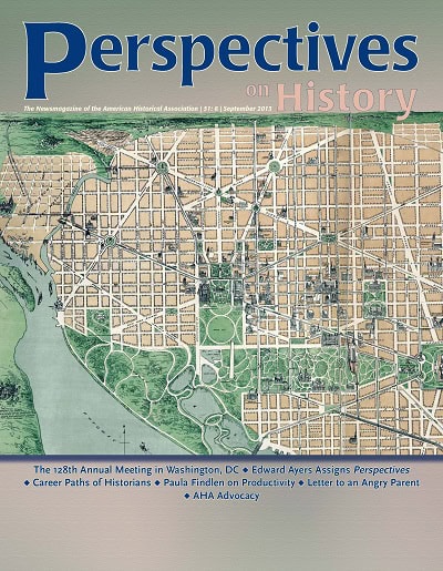
The cover image is a detail from a 1892 map attributed to James T. Dubois entitled, “The Altograph of Washington City, or, Stranger’s Guide.” An isometric view of the national capital, showing the public buildings, parks, principal churches, hotels, bridges, statues, steamboat lines, street railway routes, &c; also indicating the location of all places of public interest immediately adjoining the city.”
The highly picturesque rendering of the National Mall’s landscape was likely an interpretation of Andrew Jackson Downing’s 1851 plan, partly built but unrealized at his death in 1852. At the time of the map’s publication, the National Mall reflected the activities of various military, transportation, commercial, and social uses, as well as the individual planning initiatives of various federal agencies.
James T. DuBois, “The altograph of Washington City, or, stranger’s guide.” Washington, DC, 1892. Library of Congress Geography and Map Division, Washington, D.C. 20540-4650.
Staff