At the January 1907 meeting of the Philosophical Society of Great Britain, the American geologist Warren Upham presented a paper comparing two recent catastrophes, the 1906 earthquakes in San Francisco and Valparaíso. His analysis moved in two directions at once, invoking the emerging language of modern science—fault lines, seismic waves, geodetic measurements—while also referencing divine will. Even in the early 20th century, God still had a place in the mechanics of disaster.
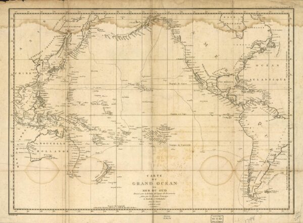
Carte de Grand Océan ou Mer du Sud. This 1788 map from the atlas of French explorer Jean-François de La Pérouse charted the Pacific basin more than a century before earthquakes would make it the center of modern seismology. Library of Congress Geography and Map Division / public domain
Upham’s paper captured a moment of epistemic instability. Scientific explanations of earthquakes were gaining ground but had not yet fully displaced older frameworks of meaning. What is less obvious—but more consequential—is where this new scientific authority would be produced. Contrary to the familiar story that locates modern science in Europe and radiates it outward, the history of seismology suggests a different geography. Over the course of the 20th century, the Pacific Rim, long treated as peripheral, became central to the production of earthquake knowledge.
This shift invites us to rethink the broader geography of modern knowledge. If we follow the seismic belt that stretches from California to Chile to Japan, what emerges is a hemispheric story in which catastrophe, rather than marginality, positioned these regions at the forefront of scientific innovation. The Pacific Rim became a center not despite its instability but because of it.
For centuries, earthquakes were understood by linking natural events to supernatural forces. In ancient Greece, Poseidon was said to shake the earth; in Japan, a giant catfish churned beneath the islands; and in the Andes, the Inca earth goddess Pachamama was said to tremble with anger when neglected. These explanations did not simply reflect ignorance. They offered coherent ways of interpreting unpredictability and destruction in the absence of systematic observation.
The Pacific Rim became a center not despite its instability but because of it.
The Enlightenment began to erode these frameworks. The 1755 Lisbon earthquake, which devastated one of Europe’s major cities, prompted a wave of philosophical and scientific inquiry. Thinkers such as Voltaire challenged providential explanations and insisted on natural causes. By the late 18th century, scientists like John Michell were proposing theories of subterranean motion. New instruments soon followed—Luigi Palmieri’s electromagnetic seismograph among the first—but through the 19th century they yielded only scattered readings of European seismic activity, disconnected from one another and from any coordinated system. Yet the transition from speculation to systematic knowledge required more than new ideas. It required instruments, institutions, and—crucially—repeated encounters with the phenomenon of earthquakes. It is here that the Pacific Rim would prove decisive.
The 1906 San Francisco earthquake exposed the limits of the existing knowledge and fragmented observation, marking a turning point toward systemic earthquake observation. In response, American scientists and institutions moved to construct a coordinated system for monitoring seismic activity. US organizations funded the development of seismograph stations across the country, including a cluster in Southern California that geologist Harry Wood built around Pasadena, Mount Wilson, and Riverside—the nucleus of what would become the Caltech Seismological Laboratory. Researchers including John Milne and Thomas Jaggar helped transform earthquake observation into a systematic, data-driven enterprise. What had once been sporadic and local became continuous and national. This emerging network did more than generate data. It repositioned the United States within a global field of scientific exchange. Seismic records collected in California could now be compared with those from elsewhere, enabling new forms of collaboration and standardization. Disaster, in this sense, catalyzed not only national infrastructure but also international scientific integration.
Chile confronted similar challenges under different conditions. Located along one of the most active seismic zones on earth, the country experienced recurrent destruction. The 1906 Valparaíso earthquake—occurring just months after San Francisco’s—highlighted the need for research on seismic risk. In 1908, the Chilean government established a national seismological service at the University of Chile. Under the direction of Augusto Döll, the institution gathered, analyzed, and disseminated information about earthquakes across the country. Its creation marked a significant moment in the integration of scientific knowledge into state structures. Chile’s case underscores a key dynamic: Repeated exposure to catastrophe could accelerate the institutionalization of science. Earthquakes were not isolated events but recurring conditions that demanded ongoing observation and analysis. In this context, scientific knowledge became inseparable from questions of governance, infrastructure, and public safety.
Nowhere was the relationship between disaster and scientific authority more pronounced than in Japan. The Great Kantō Earthquake of 1923, which killed more than 140,000 people, revealed the scale of seismic vulnerability and the urgency of systematic research. Founded in 1925, the Earthquake Research Institute (ERI) and its scientists developed influential theories—most notably the law describing the decay of aftershocks—that continue to shape the field. Japan’s experience illustrates how regions subject to extreme natural forces could become sites of epistemic authority. The very conditions that made the country vulnerable also made it indispensable to the global production of knowledge about earthquakes.
Taken together, these cases reveal a broader transformation. During the 19th century, the study of earthquakes was largely embedded within European intellectual traditions. By the mid-20th century, however, the Pacific Rim had become the primary locus of seismological research. Not merely the result of scientific progress, this shift was driven by the uneven distribution of natural phenomena and by the institutional responses they provoked. Regions once considered peripheral were, in fact, uniquely positioned to generate new knowledge because they experienced earthquakes with greater frequency and intensity than almost anywhere else on earth.
What emerged was a hemispheric network of observation and exchange linking the Americas and East Asia. Data circulated across the Pacific; instruments were standardized; theories were refined through comparison. In this sense, the rise of modern seismology cannot be understood within national or continental frameworks alone. It was, from its inception, a transpacific and hemispheric enterprise.
Modern seismology was, from its inception, transpacific and hemispheric.
The California Institute of Technology (Caltech) became the primary node through which these transpacific connections were institutionalized. On its campus in Pasadena, Japanese, Chilean, and American scientists trained together, co-authored foundational papers, and built the instruments and theories that came to define the discipline. Kiyoo Wadati’s method of plotting the logarithm of ground-motion amplitude against distance—developed in Japan from observations of local earthquakes—directly informed the magnitude scale that Beno Gutenberg and Charles Richter developed at Caltech in 1935. Cinna Lomnitz, trained under Gutenberg, Richter, and Hugo Benioff, in 1955 became the first Latin American to earn a PhD in geophysics, before returning home to direct a geophysics institute at the University of Chile.
The 1960 Valdivia earthquake—the largest recorded in the 20th century, at magnitude 9.5, and called the Great Chilean earthquake—crystallized these transpacific connections during a shared scientific event. Japanese seismograph networks had been recording Chilean earthquakes since the 1920s, and the Valdivia event produced the first clear observations of earth’s normal modes—the slow, whole-earth vibrations that follow a great earthquake, like a bell ringing after being struck. Chile’s local records let seismologists calibrate what Japanese instruments were detecting an ocean away, data that researchers on both sides of the Pacific analyzed in parallel. The exchange was not simply institutional but methodological. Each contributed observational frameworks and analytical tools that the others incorporated, producing a body of knowledge that no single nation could have generated alone. At the same time, the language of seismology created at institutions like Caltech and the ERI—magnitude scales, plate tectonics—became global, shaping how earthquakes were understood everywhere. The Pacific did not simply contribute to scientific knowledge; it redefined its center.
The history of seismology complicates familiar narratives about the geography of modern science. Rather than diffusing outward from a stable European core, knowledge about earthquakes emerged in regions often labeled as marginal. This dynamic resonates with broader historiographical shifts that emphasize the circulation of knowledge across borders and the role of so-called peripheries in shaping global modernity. Recent work in disaster studies has highlighted how earthquakes reshape societies by transforming cities, governance structures, and collective identities. They also reshape knowledge. They determine where research is conducted, which questions are prioritized, and whose expertise becomes authoritative. To speak of a “seismic Pacific,” then, is not simply to identify a region of geological activity. It is to recognize a historical process through which the geography of knowledge was reconfigured.
When Upham stood before his London audience in 1907, he inhabited a world in which scientific and theological explanations of earthquakes co-existed uneasily. Within a few decades, that balance would shift decisively toward science and the Pacific. By tracing the development of seismology across the Pacific, we can see how regions long considered peripheral came to occupy a central place in the modern understanding of the earth. The aftershocks of that transformation are still with us—not only in the science that measures earthquakes but in the global structures of knowledge that those measurements helped to build.
Cristián Castro is director of the School of History at the Universidad Diego Portales.
This work is licensed under a Creative Commons Attribution-NonCommercial-NoDerivatives 4.0 International License. Attribution must provide author name, article title, Perspectives on History, date of publication, and a link to this page. This license applies only to the article, not to text or images used here by permission.